
Build it on the map you already have.
Upload your venue drawing or use a live street map while you set things up. Add booths one at a time or place a whole grid, then move each space where it belongs.
Interactive event maps
Build the grounds, place every participant, and keep the public view current from one map.
Real Karsenics product · Fictional event data
Map workbench
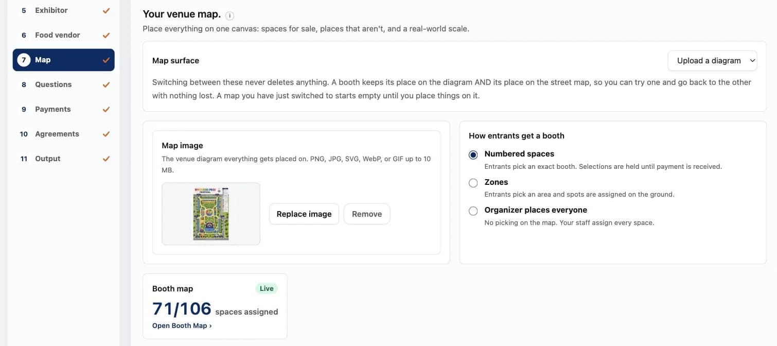
Real product · Riverbend Pride is fictional
Watch it run
A short film of the booth map in the real product, with demonstration data. No sound needed.
From setup to event day
A drawing becomes more useful when it carries the rules, availability, and placement record with it.
Upload your venue drawing or use a live street map while you set things up. Add booths one at a time or place a whole grid, then move each space where it belongs.
Let people choose a numbered space, let them choose an area while your team assigns the exact spot, or keep every placement with the organizer.
Open, held, and confirmed spaces update from registrations and payments. Your staff works from the same placement record that feeds the participant and public views.
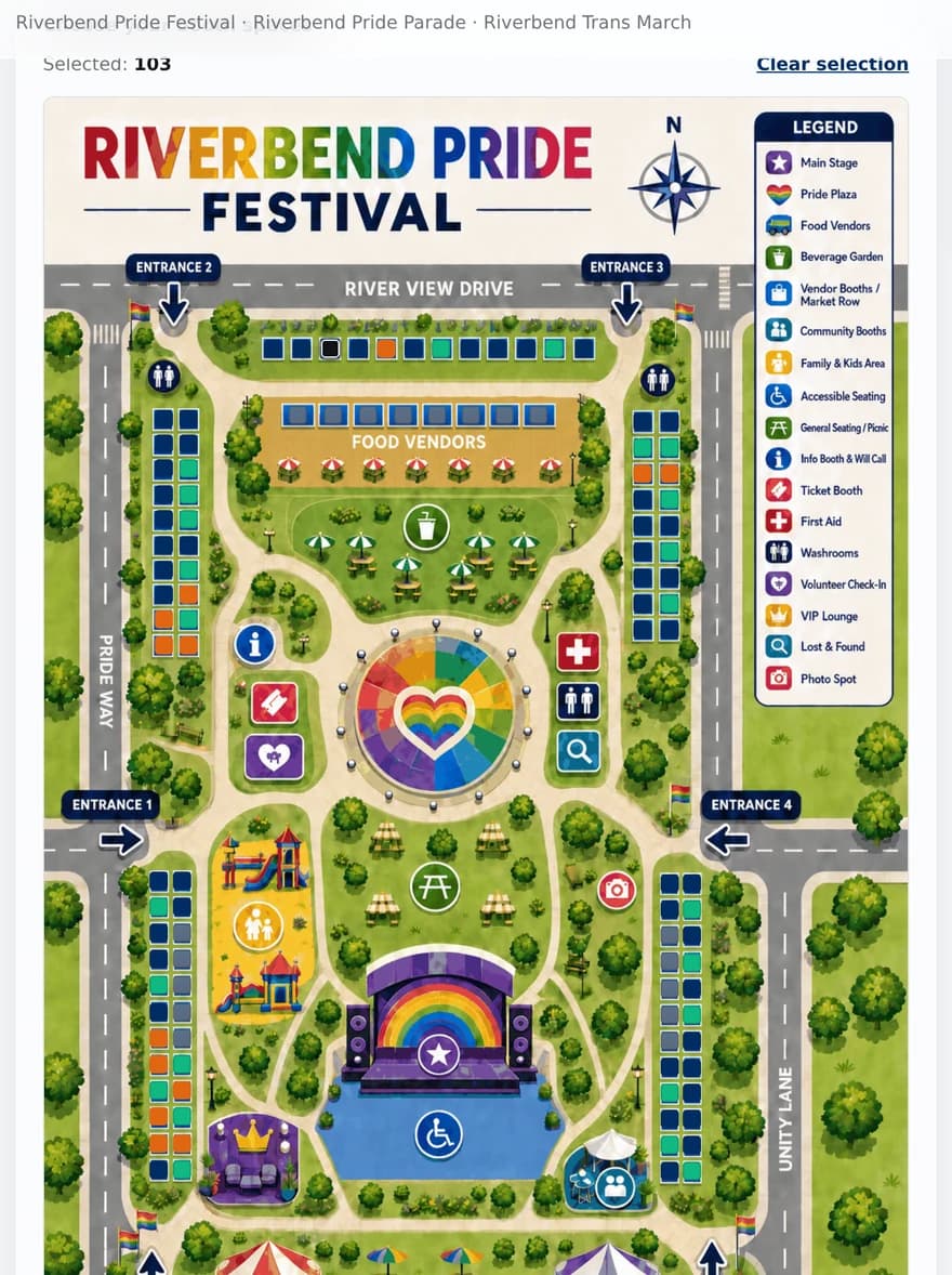
Participant view · Riverbend Pride is fictional
Let them choose
People see what is available now and choose inside the rules you set. Spaces reserved for food vendors or sponsors stay unavailable to everyone else.
What the map handles
Use the map during planning, registration, and event week without rebuilding the same placement list in three places.
Sell numbered booths, group spaces into areas, and mark places such as entrances, first aid, and check-in.
Reserve spaces for standard vendors, food vendors, or sponsors, and check the rule again during registration.
Find a vendor or booth number quickly, and narrow the view by the kind of participant using the space.
Set the scale on an uploaded drawing or measure true distance while working on the street map.
Keep separate grounds and placements when a season includes more than one festival.
Decide whether to publish the festival map, the parade route, and participant names for each event.
Share it when you are ready
Publish a searchable view of the festival grounds with current availability and participant filters. Keep it private until it is ready, and keep any participant who chose not to be listed off the public page.
The public map uses a prepared map image, so visitor traffic does not add live-map usage costs.
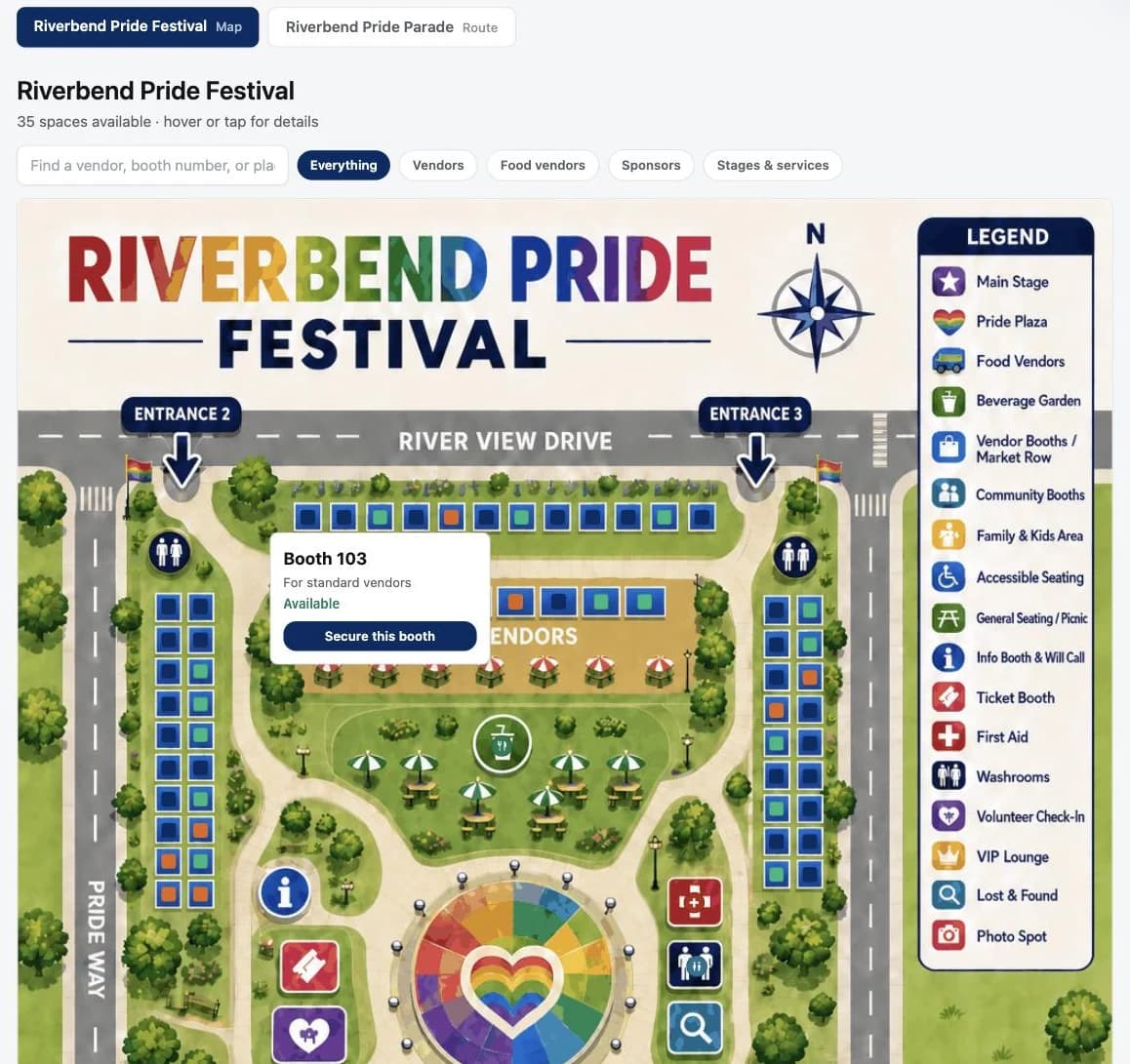
Public visitor view · Fictional demonstration
Before we talk
Bring the map or drawing you use today. We can talk through what would need to change.
No. You can start from the drawing you already use, or work from a live street map during setup. We help you decide which approach fits your event.
Yes. You can allow exact booth selection, allow people to choose an area, or keep placement entirely with your staff. The choice is set for each event.
The space is held during the card-payment window so two people cannot buy it at once. Check and direct-payment holds remain until your team records the payment or releases the space.
No. The working map can stay with your team. If you publish it, you choose whether the festival grounds, parade route, and participant names are visible.
Bring your venue map
We’ll walk through placement, participant choice, and the view your team needs on event day.
Join Early Access